
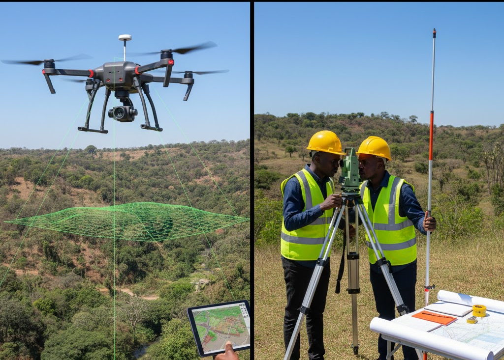
As technology continues to evolve, the debate between drone mapping and traditional survey methods has gained traction. This article explores the unique advantages and challenges presented by both techniques, highlighting how these approaches can significantly impact the efficiency and accuracy of surveying tasks.
Understanding Drone Mapping
Drone mapping is a revolutionary technique that employs unmanned aerial vehicles (UAVs) equipped with advanced cameras and sensors to capture high-resolution images and data from above. This method provides real-time insights, enabling quick decision-making processes. By utilizing specialized software, the collected data is converted into accurate geospatial maps, 3D models, and other valuable visual representations.
The Advantages of Drone Mapping
- Speed: One of the most significant advantages of drone mapping is its speed. Drones can cover vast areas in a fraction of the time required for traditional surveying techniques.
- Cost-Efficiency: Aerial surveys can be more affordable in the long run as they reduce labor and equipment costs.
- Accessibility: Drones can reach hard-to-access locations, providing data where traditional methods may struggle.
- Accuracy: Advanced sensors can capture detailed images, leading to enhanced accuracy in data collection and analysis.
Traditional Survey Methods: An Overview
Traditional survey methods, including theodolites, total stations, and GPS technology, have long been the backbone of land surveying. They rely heavily on skilled surveyors who manually collect data through various instruments. While effective, these techniques come with their own set of challenges.
The Drawbacks of Traditional Survey Methods
- Time-Consuming: Gathering data through manual methods can be labor-intensive and time-consuming, often extending project timelines.
- Labor-Intensive: A skilled workforce is necessary for operation, which can lead to higher labor costs.
- Weather Dependency: Traditional surveying activities can be significantly impacted by adverse weather conditions, causing potential delays.
- Limitations in Data Collection: Certain terrains and inaccessible areas pose challenges that could hinder comprehensive data collection.
Comparison of Accuracy and Precision
Accuracy and precision are paramount in both drone mapping and traditional methods. Drone technology has made significant strides in this regard, often exceeding the precision of manual surveys. With the help of sophisticated software and high-resolution imaging, drones can produce highly detailed and precise topographic maps, whereas traditional methods may not always capture the same level of detail due to those inherent limitations.
Situations Favoring Drone Mapping
Several scenarios favor drone mapping over traditional methods:
- Large Scale Projects: For extensive areas, such as agricultural fields or construction sites, drones can quickly survey and analyze.
- Remote Locations: Drones excel in surveys of regions that are difficult to access on foot, such as mountainous or densely forested areas.
Situations Favoring Traditional Survey Methods
While drone technology reigns supreme in many cases, traditional methods should not be dismissed. They still hold merit in specific situations:
- Detailed Measurement Tasks: When precise measurements are crucial, traditional methods may offer the reliability needed.
- Legal and Regulatory Compliance: Some legal frameworks still endorse traditional surveying techniques for compliance reasons, necessitating human intervention.
The Future of Surveying: Integrating Technologies
As the field of surveying continues to evolve, the integration of drone mapping with traditional methods is becoming increasingly common. This hybrid approach can offer the robustness of established techniques combined with the speed and efficiency of aerial mapping. By leveraging both methodologies, stakeholders can optimize data collection while ensuring compliance with regulations.
Keeping Up with Technological Advancements
The technological landscape is ever-changing, and surveyors must stay abreast of innovations to remain competitive. Embracing new technologies, such as machine learning and artificial intelligence, will further enhance both drone mapping and traditional survey methods, making them more efficient and reliable than ever before.
In summary, both drone mapping and traditional survey methods have their unique advantages, tailored to different project needs. For those looking to enhance efficiency and accuracy in data collection, embracing drone technology is a wise choice that an expert surveyor can help you integrate seamlessly.